|
|
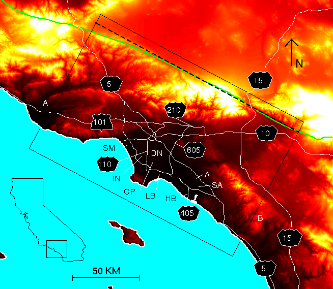
(a) Topographic map of southern California centered on the LA region. The
rectangle shows the areal extent of the simulation. The SAF is shown by the green
line, our approximation of the fault by the dashed white line. Thick solid white line
is the coastline of southern CA. The thin white lines depict major freeways in the
modeling area. The dashed white line B-B' is a profile used for displaying
seismograms. A is Anaheim, CP is Compton, DN is Downey, HB is Huntington
Beach, IN is Inglewood, SA is Santa Ana, and SM is Santa Monica.
|
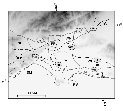
Topographic map of the Los Angeles area model. The dash-dot lines show the surface
projections of faults where we have simulated ruptures in this study: Palos Verdes (PV), Elysian Park
(EP), Santa Monica (SM), northern Newport-Inglewood (NI), and the faults that ruptured during the
1994 M 6.7 Northridge (NR), the 1933 M 6.4 Long Beach (LB), and the 1987 M 5.9 Whittier-Narrows
(WN) events. The thin solid lines depict major freeways in the modeling area. A is Anaheim, CP is
Compton, DN is Downey, HB is Huntington Beach, IN is Inglewood, SA is Santa Ana, and SM is Santa
Monica.